GeoPlan package

- about programme
- modules
- possibilities
- example maps
- advantages of the GeoPlan programme
- general information
- additional possibilities
- system requirements
About programme
The GeoPlan package is used to create deposit, hydrogeological, geological and engineering maps, enabling the generation of isolinear maps, modelling and calculation of the area and volume. The program offers a spatial modelling option as well as the ability to work on several models simultaneously.
Modules
The GeoPlan software is composed of the following modules:
- Map editing module input of descriptive and graphic components needed to produce maps according to demands;
- Digital and raster base input module uploading with raster base calibration;
- A finished map export module (into other programmes);
- Data uploading module (from the GeoStar database, other programs (e.g. Excel) and text files);
- Data edition module - changes and additions in geodesic object coordinates;
- A module for creating soil and resources occurrence models to generate deposit maps and (pulp, layer and isolinear) hydrogeological and physicochemical parameter models;
- Model edition module to modify previously created models;
- Operation planning module to register operational progress;
- A module for creating, editing and verifying map areas (calculation blocks, land parcels, plots, division of existing areas etc.);
- A module for calculating areas, volumes and resources in specific sections and levels;
- a module for copying and pasting graphic objects made on other maps or in other applications (e.g. logos, graphs, legends, descriptions, register extracts etc.
Possibilities
1.The package enables creating of isolinear maps on the ground of
text files and database which are available in SQL language (including GeoStar database). The package has been equipped with the special editor which enables manual enter and correct of measuring or deposit limiting items. Using this data the programme interpolates regular grid with the results of wanted parameters in its nodes. Currenltly the programme uses two (optionally 3) interpoler methods, but the number of them will be successfully expanded. The creation of regular grid allows to produce a map with the schedule of examined parameter, isolinear map and also to calculate module resources. The developed graphic editor enables its quick and simple entry.
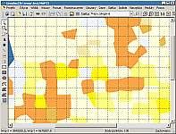
Isolinear, geological, hydrogeological, geological engineering maps

Advantages of the GeoPlan programme
- The option of creating of maps of different types on the same drawing;
- Many users can work in network, with the same data (cooperating with GeoStar 5);
- Help tools for quick creating of the maps;
- The option of creating of digital documentation and sending it to a client saved in Word , Excell or Cad files;
- Data correct in the wordsheet corrects all the document created;
- The option of creating more than one models on the same map (ex. Models of land surface, water transfer levels, exploitable levels,deposit models) with the possibility of siwtching or seeking for relationships between them;
- The option of creating and printing out of free large formats possible to print the marked fragments of the map;
- Co-operation with Surfer, Microstation programmes and other applications;
- Open structure is possible to extend and add the modules needed;
- Direct co-operation with the other applications of Soft-Project Company;
- All year technical support with technical retraining of a client are available on demand;
- Relatively low costs of purchase and putting into practise compared with the other world known products of this group;
- Free actaulizations during all year;
- Experience gained during numerous initiations over the country.
General information
- Data reading in , in D Base database (GeoStar 3) or ORACLE/INTERBASE (GeoStar 5);
- Modeling by three methods: reverse distance method, triangle method and kriging method wit the possibility to apply data exchange from Sarfer programme.
Additional possibilities
- Export of drawings in DXF format (sections), EMF,WMF;
- Windows clipboard service;
- Option of copying of drawings into Word and Excell programmes;
- Option of section's replacing into Autocad programme (Geostar 5).
System requirements
- PC running Windows 98, Me, 2000, XP, or higher;
- Procesor Pentium 500 or more;
- 256 MB RAM minimum;
- 30 MB of free hard disk space;
- 1024 x 768 minimum monitor resolution.
menu
contact
Soft-Project
51-616 Wrocław
(Poland)
ul. Parkowa 25
+48 (071) 3488222
51-616 Wrocław
(Poland)
ul. Parkowa 25
+48 (071) 3488222


